June 2025
Written by Meiardhy Mujianto, Community-based agroforestry enterprises for sustainable and collective land use, [email protected]
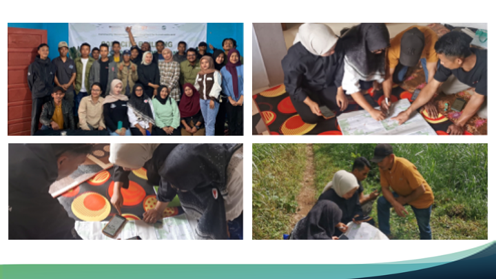
Now I can pin my own land on the map,” says Siti, a vegetable grower from Gondang. Her pride echoed through a two-day workshop run by Yayasan Relung Indonesia and the KPWPL cooperative under the IKI Small Grant. Twenty-one farmers—nine women—learned to read SMCA suitability maps, drop placemarks in Avenza Maps and design three agroforestry models: coffee-and-timber live fences around high-altitude vegetables, silvopasture on calliandra fodder plots, and multistrata systems below 1000 m.
Quizizz results proved the leap: average scores jumped from 5 190 to 7 242; women gained 25 points, topping the 21-point increase for men and hitting 92 percent accuracy. On the wall-sized map the women led sticker placement for erosion gullies and proposed manglid timber strips to ease the village’s building-wood shortage.
The session ended with a new KTH Mapping Team—three of its five members are women—tasked with updating data and tracking action plans over the next quarter. Simple smartphones and learning-by-doing have turned traditional caretakers into spatial navigators, charting a more sustainable—and more inclusive—future for Petungkriyono.
Projects
Community-based agroforestry enterprises for sustainable and collective land use